
Confirming the “Aramco” Strike… “NASA” Maps Detect Thermal Hotspots and the Outbreak of Fires in the Heart of Riyadh
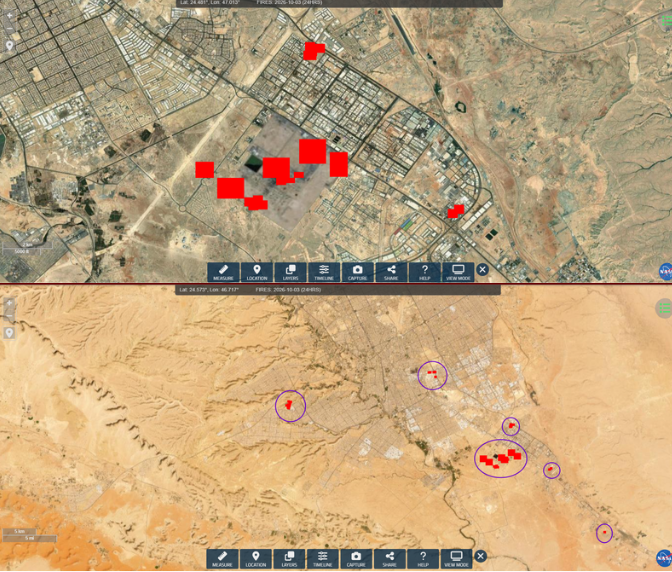
The maps of the Fire Information System of the “NASA” space agency revealed on Saturday the continuation of combustion hotspots in a number of areas of the Saudi capital, Riyadh.
Exclusive Follow-ups — Al-Khabar Al-Yemeni:
The attached image shows the detection of major thermal points at several locations, with readings recorded at 19:35 local time, at a confirmation level of 80%, in addition to an earlier detection at 08:40 with a confirmation level exceeding 90%.
This coincides with the announcement by the Yemeni Armed Forces of carrying out an operation with ballistic missiles and drones that targeted the Aramco company in Riyadh, affirming that the targeted sites were hit and fires broke out in them.
The data of NASA’s satellites support what was stated in the Yemeni Armed Forces’ statement regarding the targeting of sites in the Saudi capital, Riyadh, as the fire monitoring maps showed the recording of thermal hotspots in several areas of the capital.
Since the morning, activists and media platforms have published filmed scenes documenting the rise of smoke columns and tongues of flame from scattered locations in Riyadh, including sites affiliated with the Aramco company, along with other areas.